
My diary
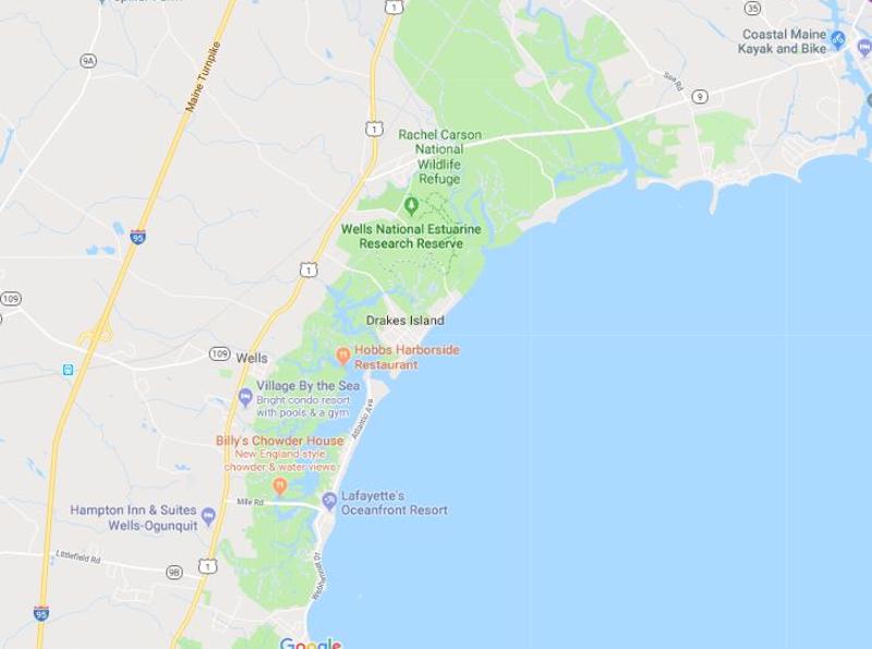
The Rachel Carson National Wildlife Refuge is a 9,125-acre (37 km2) National Wildlife Refuge made up of several parcels of land along 50 miles (80 km) of Maine's southern coast. Created in 1966, it is named for environmentalist and author Rachel Carson, whose book Silent Spring raised public awareness of the effects of DDT on migratory songbirds, and of other environmental issues.
https://www.fws.gov/refuge/rachel_carson/
Directions and Contact Info
The refuge entrance is located on Port Road (Route 9) in Wells and just minutes from exit 19 on I-95. From exit 19, turn left onto Route 9/ Route109. At stop light, turn left onto Post Road (Route 1 North). Just past the Maine Diner, turn right onto Port Road (Route 9) and follow for approximately ¾ mile; turn right into the refuge entrance.
321 Port Road, Wells, Maine 04090
(207) 646-9226
[email protected]
Nearly 100,000 visitors use the one-mile Carson Trail at the Wells headquarters; one of five developed trails on the refuge. The headquarters trail in Upper Wells has an informational kiosk and composting restrooms. The 1.8-mile Cutts Island Trail in Brave Boat
blackskimmers
17 chapters
16 Apr 2020
Rachel Carson National Wildlife Refuge
August 18, 2018
The Rachel Carson National Wildlife Refuge is a 9,125-acre (37 km2) National Wildlife Refuge made up of several parcels of land along 50 miles (80 km) of Maine's southern coast. Created in 1966, it is named for environmentalist and author Rachel Carson, whose book Silent Spring raised public awareness of the effects of DDT on migratory songbirds, and of other environmental issues.
https://www.fws.gov/refuge/rachel_carson/
Directions and Contact Info
The refuge entrance is located on Port Road (Route 9) in Wells and just minutes from exit 19 on I-95. From exit 19, turn left onto Route 9/ Route109. At stop light, turn left onto Post Road (Route 1 North). Just past the Maine Diner, turn right onto Port Road (Route 9) and follow for approximately ¾ mile; turn right into the refuge entrance.
321 Port Road, Wells, Maine 04090
(207) 646-9226
[email protected]
Nearly 100,000 visitors use the one-mile Carson Trail at the Wells headquarters; one of five developed trails on the refuge. The headquarters trail in Upper Wells has an informational kiosk and composting restrooms. The 1.8-mile Cutts Island Trail in Brave Boat

Harbor Division has trail signs and restrooms. The Timber Point Trail is located in the Little River Division at the end of Granite Point Road in Biddeford, Maine. This 1.25-mile walk takes you through a variety of habitats and ends on the rocky shore over looking the Atlantic Ocean. Carry-in boat access is available on Chauncy Creek at the intersection of Cutts Island and Seapoint Roads in Kittery, the Little River launch site is located at the end of Granite Point Road in Biddeford, and a third launch site is at the Spurwink River Division by Rt. 77 in Scarborough. Parking is available through verbal agreement with the Towns. The Goosefare Brook Trail and overlook offers parking, a short stone-dust trail and interpreted observation platform with views of the marsh and beach. However, there is no beach access from this location. The Bridle Path and Atlantic Way and Ted Wells Trails provide views of refuge habitat in Kennebunk and Saco and Old Orchard Beach. These trails are located on and adjacent to refuge property and are maintained by municipal or private non-profit organizations.
There are three areas within Rachel Carson NWR where non-motorized canoes and kayaks can launch and land in support of wildlife observation and fishing during daylight hours only.
These areas are designated by “Carry In Boat Access Only” signs and are located at:
- Chauncey Creek, on Seapoint Road in Kittery, Maine
- Little River, at the end of Granite Point Road in Biddeford, Maine
- Spurwink River, at the fish pier on Route 77 in Scarborough, Maine
1.
Itinerary Overview
2.
Kennebunkport
3.
Rachel Carson National Wildlife Refuge
4.
Portland
5.
Ovewview of Downeast and Acadia
6.
Stonington
7.
Isle auHaut
8.
Bar Harbor on Mount Desert Island
9.
Acadia National Park
10.
Biking in Bar Harbor
11.
Baker Island Cruise
12.
Little Cranberry Island
13.
Directions and Info on the Kaplan Cabin
14.
Acadia Checklist
15.
Healthy Breakfasts with Outdoor Seating
16.
Acadia Coffee
17.
Recommended Lunch Spots
Share your travel adventures like this!
Create your own travel blog in one step
Share with friends and family to follow your journey
Easy set up, no technical knowledge needed and unlimited storage!