
WA Wheatbelt & Goldfields Tour - 2016 - 2017
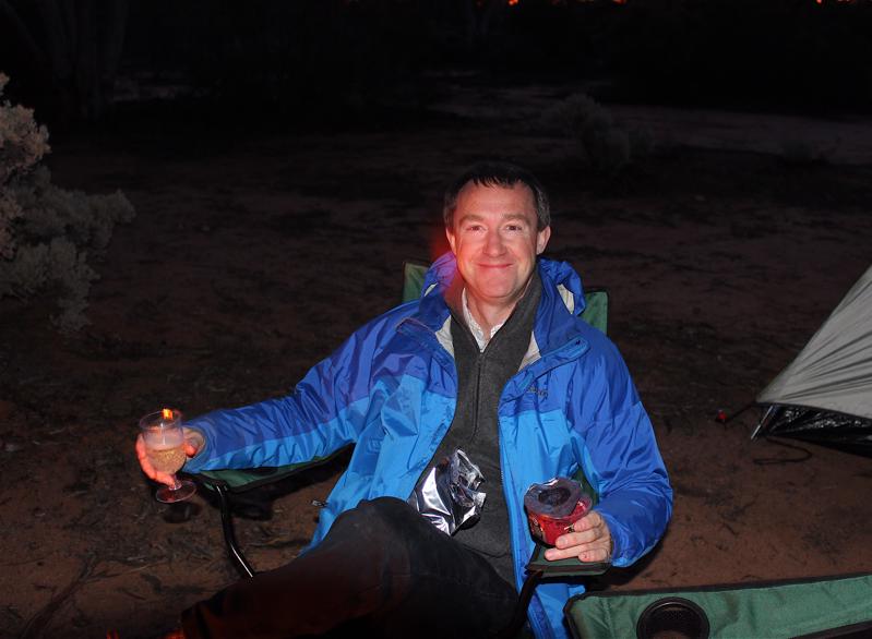
We arrived just before dusk and set up camp quickly with the tent and a large camp fire. There were only two other camper families, otherwise we had an area the size of Ireland to ourselves. We settled in for the night and then about 2.00am a car arrived. We could hear campers getting out and setting up. In the morning we saw that it was a family and the guy in charge looked a real rough neck. There were crates of beer and an axe for the timber chopping, but when we got talking to him he was a nice bloke. We managed to purchase five litres of fuel off him to increase our capacity in case anything went wrong on our run out to Hyden. Lesson for next camping trip is to bring more fuel.
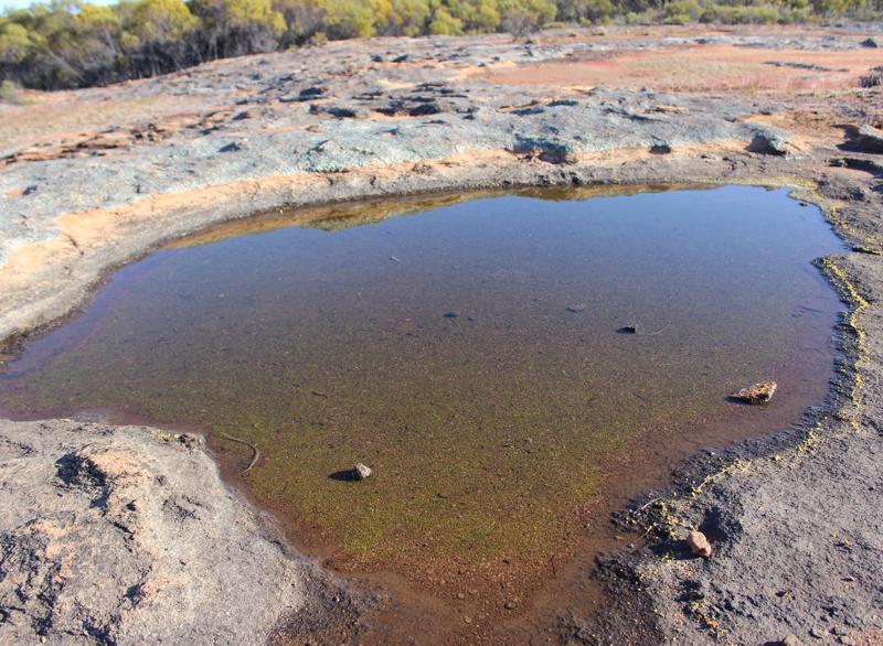
The only water in the area is what can be captured in the wet season by putting dams along granite rocks to catch the water. This happens for three months during the year and then after that its dry time. You can survive one dry year, but two in a row is disaster.
We got up early ( a hot coffee got Tracy started!) and went for a walk along the top of the rock. The view was great and you could see to the horizon and and all that could be seen was scrub forest
Tracy McPhee
13 chapters
15 Apr 2020
Burra Rocks to Dumbleyoung
September 24, 2016
We arrived just before dusk and set up camp quickly with the tent and a large camp fire. There were only two other camper families, otherwise we had an area the size of Ireland to ourselves. We settled in for the night and then about 2.00am a car arrived. We could hear campers getting out and setting up. In the morning we saw that it was a family and the guy in charge looked a real rough neck. There were crates of beer and an axe for the timber chopping, but when we got talking to him he was a nice bloke. We managed to purchase five litres of fuel off him to increase our capacity in case anything went wrong on our run out to Hyden. Lesson for next camping trip is to bring more fuel.
The only water in the area is what can be captured in the wet season by putting dams along granite rocks to catch the water. This happens for three months during the year and then after that its dry time. You can survive one dry year, but two in a row is disaster.
We got up early ( a hot coffee got Tracy started!) and went for a walk along the top of the rock. The view was great and you could see to the horizon and and all that could be seen was scrub forest
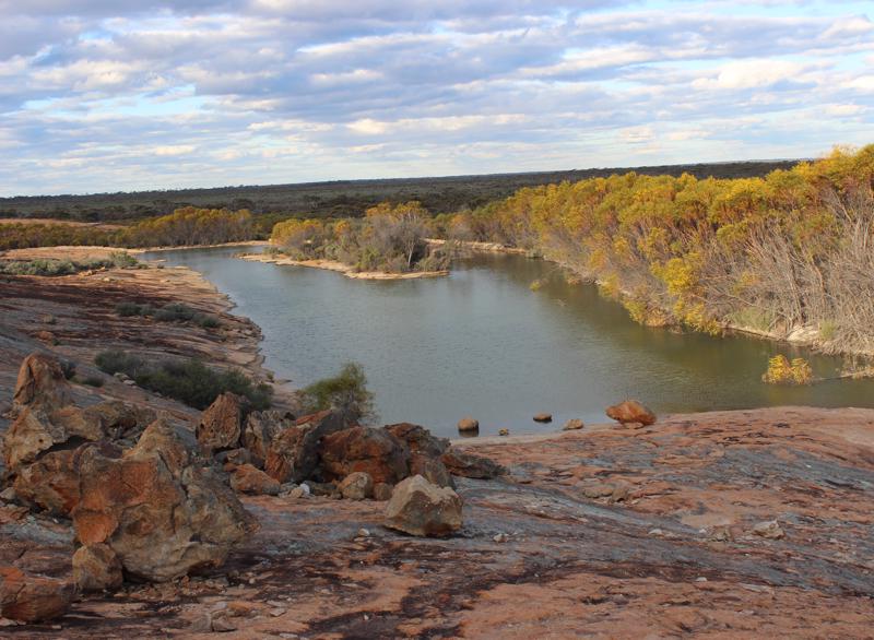
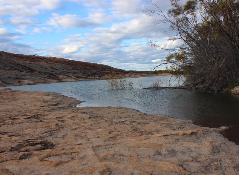
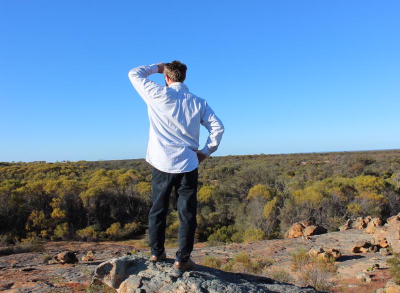
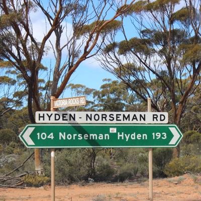
and the occasional rock. We headed from Barra rocks via Victoria Rocks Road to the small town of Hyden cross country. We planned to stop in at many of the small historic sites along the Hyden to Norseman Road, so setting off early meant we were able to see a fair bit that day.
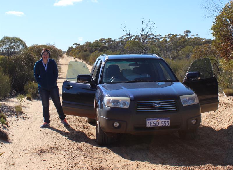
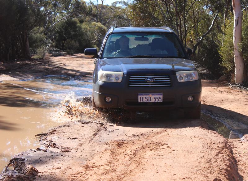
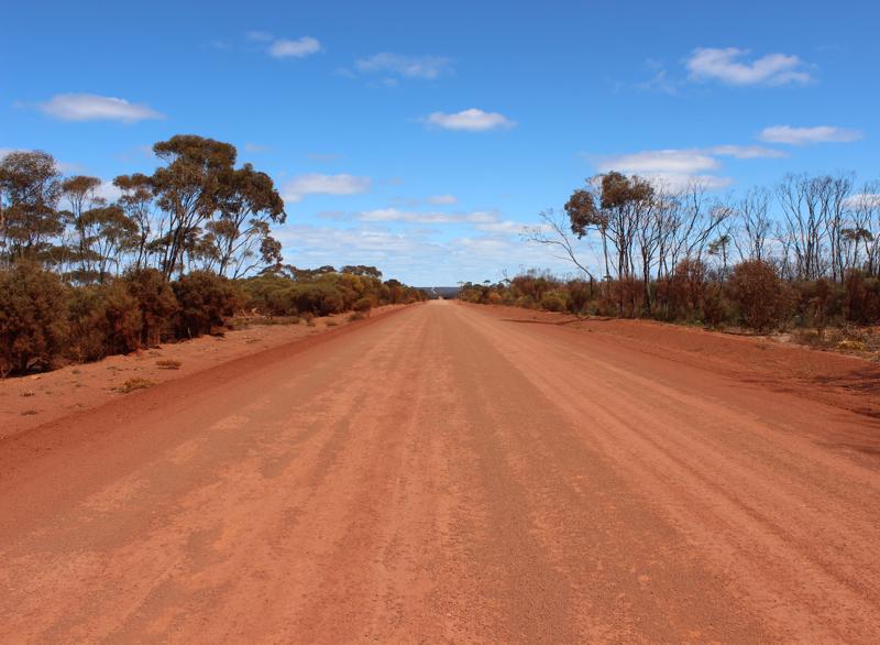
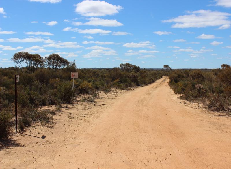
Victoria Rocks Road led us out of the campsite. It was dirt and stone and had some fun muddy patches to play in. We really should have had a 4x4, but my little Subaru forester bravely went on and the road was generally passable, but some areas we needed to take chicken runs to the side. We met no cars for over three hours and only two before we got to the main dirt road out of the area. In total we meet two cars on a journey of about 400km. The area is so quiet and deserted. Mile after miles of empty forest and open landscape.
The topography of the area is interesting. It’s all Ordovician or Permian in age and so greatly eroded and down to base rock. The
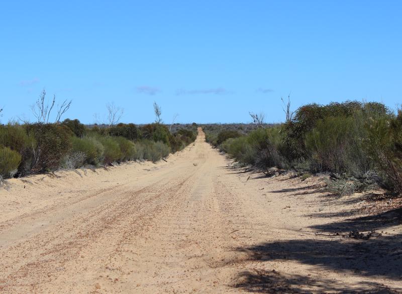
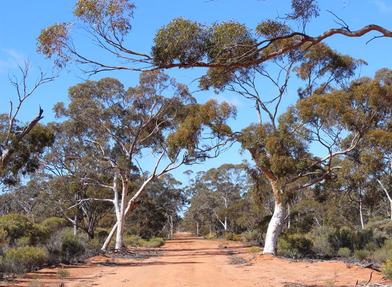
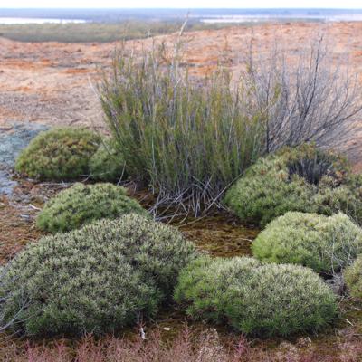
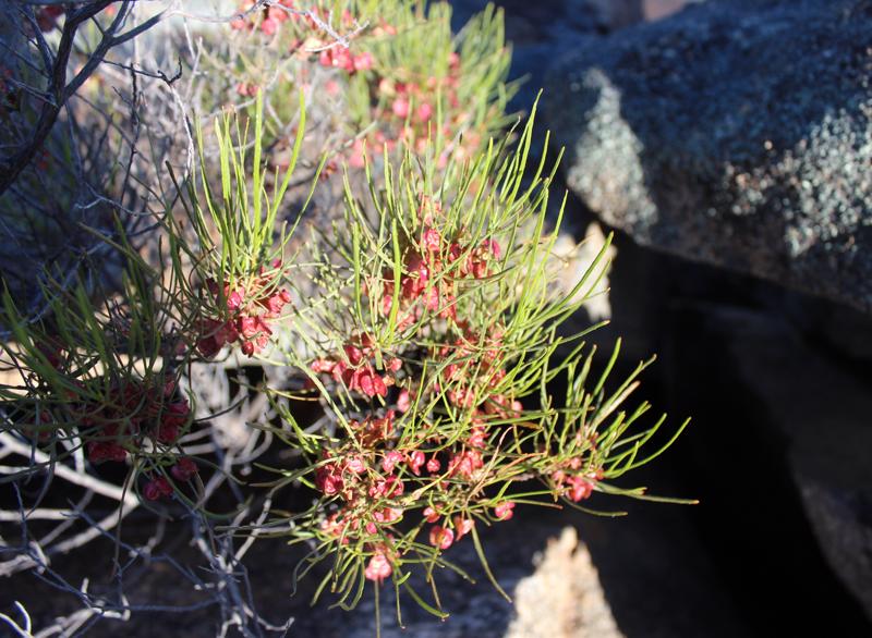
goldfields area is mostly iron based with dry and ferrous soils. The vegetation follows this in that it is stunted and scrubby. This is due mainly to lack of minerals and water. So on one side of the divide is massive scrub forests and dirt roads and then as you get to the state border with the state rabbit proof fence it changes to the corn fields and sealed roads. This area gets more water, the rocks are more sedimentary and so better for mineral access. The change is over about 300 km between Baker lake and Mt Holland. The trees change throughout the journey and in the middle of this desolate area, a certain type of gum tree grows only in this area. It’s interesting as they like nickel and areas with them are full of minerals and generally you find a nickel mine somewhere.
Along this road we pulled into a little camping area called "The Breakaways". so called due to the shapes of the limestone rocks featured in the area. A really lovely little place. It was also clear that
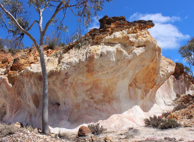
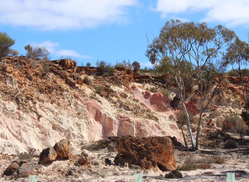
regeneration is a main aim in the area as noted by the small and many new little trees planted. A lovely little spot to camp at - however, we did note the flies would be the biggest negative.
In the 1960’s in an area around Liddelow reserve they tried to grow crops further east of the main crop area around Hyden, but to no avail, and a smart minister decreed no farming east of the rabbit proof fence just outside Hyden. That means large areas of WA were left untouched and survived in a natural state. Anyway the area would have been cleared of support foliage and the crops would at best only have survived two out of five years. It would have been an ecological disaster.
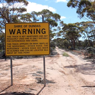
We stopped in at the start of the famous Holland Track. A real rough and ruggered 4x4 tack for serious enthusiasts - so we thought. Upon meeting a group of trek setters at the entrance we were told it was
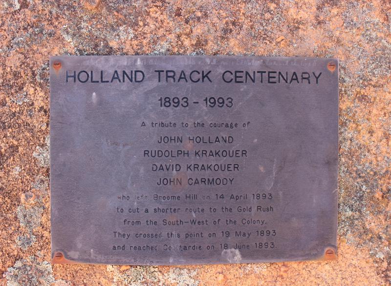
passable in the Subaru - next trip!.
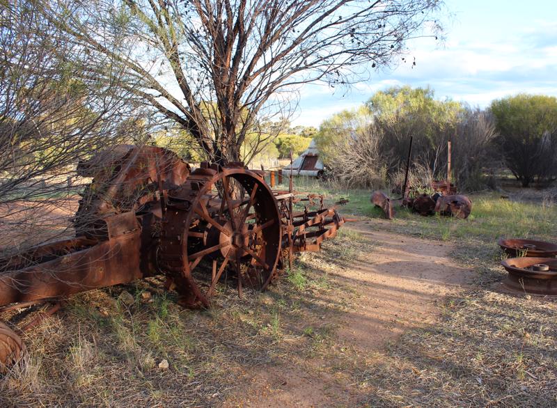
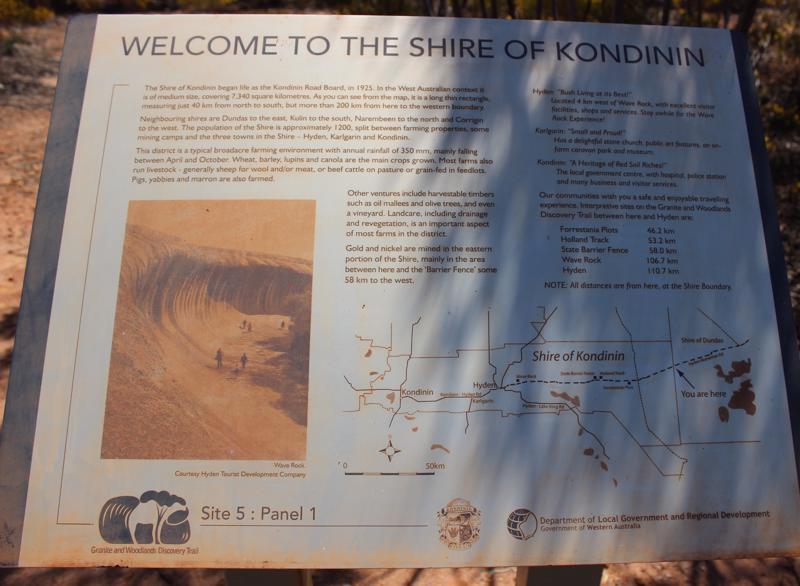
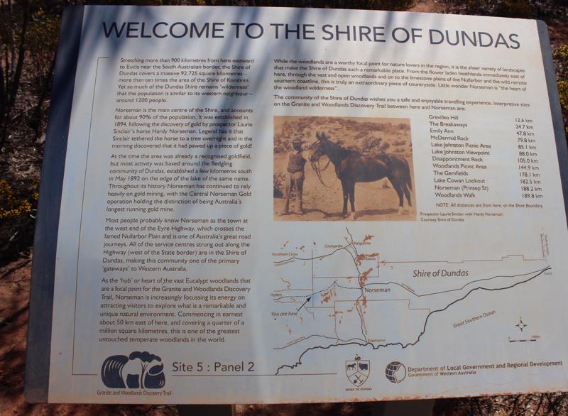
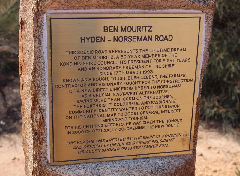
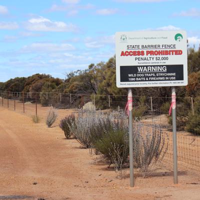
We also found some of the historic sites along the way to Hyden quite interesting. The Kondinin/Dundas shire border, state barrier fence. Lots of little bits of history that seem to be forgotten.
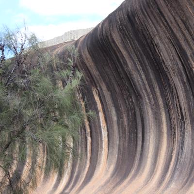
The main reason, some would say unkindly the only reason, to visit Hyden is the famous wave rock. It’s a rock that has been eroded from the centre out by accretion and wind abrasion to give a wave like appearance and it is quite impressive, but after you have looked at it for a few minutes it’s time to move on. We did a walk about and over the rock and saw the standard water dam, and of course the local golf course. All these small rural towns seem to have a small golf course. It was clearly the thing to do in the old days and got all the people together for a social occasion, and surprisingly even with the falls in population they still survive. The greens get watered but the rest of the fairways get left to the gods to survive on their own.
The climate of WA has mainly south westerly frontal belts that come in with some water, but lose it quickly once they hit land. That means that as you go east from the coast the rain shadow dries up and by the time it gets to Hyden in many years the rain is just enough to fill the reservoirs, and crop yields can be poor and even fail.
Nearly every small town in this area grew up as a grain depot stop on the rail lines and in many cases there is nothing there now, but a central grain depot for picking and storing grain for the train to take away. They are all faded memories of a time long past.
We filled up with fuel in Hyden and then headed to our next stop at Dumbleyung was to take us to the centre of the wheat fields of WA.
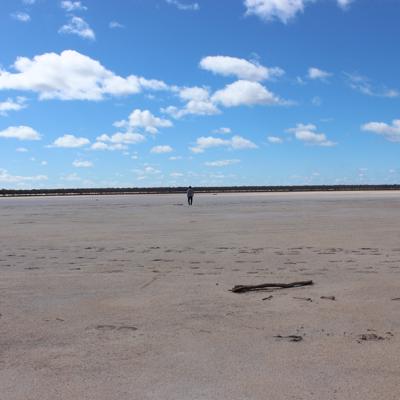
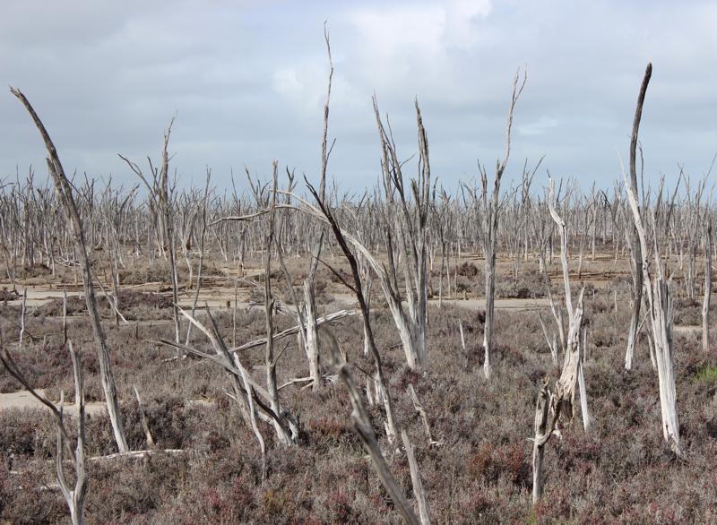
The drive was now through large fields and empty roads. There are some lakes you pass, but they are mainly salt lakes. The salt levels have increased as the water table has risen due to the clearing of trees. The trees had kept the water level low, but now it’s reaching the top. There is a movement to sow trees where possible in the low lying areas to stop the salt, but in some cases it’s too late. We came across lakes with dead trees all over as the salt killed them. The most obvious one was Kondinin lake, it’s like a movie scene out of the “Lord of the rings” in Mordor.
We finally arrived in Dumbleyung about 5.00 and got to the town campsite Once again it was a very tidy neat place. There was only one other guest caravan with a grey nomad couple that had sold their house and were traveling around Australia, stopping as we did in the small places. We had a shower and headed to explore the town. Three minutes later we are back!
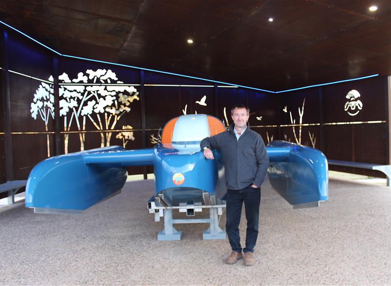
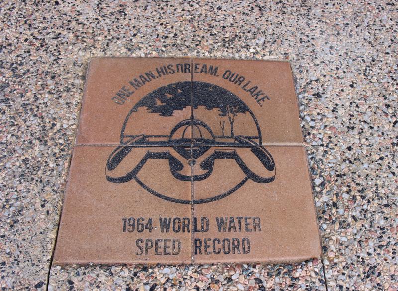
The amazing thing about Dumbleyung is that they had the “blue bird” speed boat. This was a boat that set the world’s fastest overwater record and was in all boy’s magazines when I was small. I assumed it was set in California salt lakes etc., but it was set on the salt lake in Dumbleyung. That’s like Shillelagh in Irish terms. The boat was there and the town has plaques for the people who set the record to commemorate them and the event. Its the only thing famous about the town so they are making the best of it.
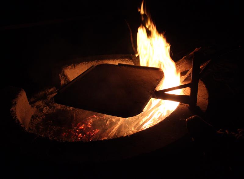
We had our dinner on our little stove and then went for a walk to see the local pub. It’s just reopened after been closed for a few months. At the local pub we played a few games of pool and met the three locals. There was a guy who had lived there all his life and ran a contracting business. He explained that since he went to school the high school had closed and that his two daughters would need to go to boarding school to finish secondary school. He will live here till he dies, but there is no next generation. One of the farmers we met in the pub was a mountain of knowledge. He said the land yields were about 2 tonne of corn a hectare. The farms were all about 6,000 hectares in the 1990’s, but now to survive you needed to have over 16,000 hectares and in many cases much more. The tractors are all mechanised and can be driven remotely, so the need for farm labour is gone. A contractor with two people can manage a business that would have taken six or seven workers. The farms are now so large that on some roads you can drive an hour and not see any houses.
There are the remains of houses that have falling apart as the land has been bought, but no one has taken the properties over. The remaining farms are usually parents whose kids have fled to the bigger towns so the depopulation is increasing. The area had over 400 farms and now has about 20. No need for schools, churches, shops etc. The roads are beautifully kept and clean but it’s like being in a deserted landscape.
The sky was clear and the milky way was vivid and flashing before us, but Tracey after three minutes of admiring this decided that it was bloody cold and was soon snuggled into the tent and enjoying the benefits of a warm doona and sleeping bag.
1.
Introduction
2.
Perth to Burra Rocks via Wyalkatchem & Kalgoorlie
3.
Burra Rocks to Dumbleyoung
4.
Dumbleyung to Quairading
5.
Quairading to Home
6.
Perth to Dalwallinu
7.
Dalwallinu to Yalgoo
8.
Yalgoo to Morowa
9.
Morawa to Perth
10.
The Gold fields Perth to Mt Magnet
11.
Mt Magnet to Leonora
12.
Leonora to Westonia
13.
Westonia to Perth
Share your travel adventures like this!
Create your own travel blog in one step
Share with friends and family to follow your journey
Easy set up, no technical knowledge needed and unlimited storage!