
WA Wheatbelt & Goldfields Tour - 2016 - 2017
So it is Thursday evening at 4.00pm and we start to head out of Perth. The weather is nice, but clear skies foretell a cold night. The road to Midland is the usual commuter belt, but once past we head up the hill into the Perth hills the shops fade away to rural houses and country retreats in the trees. The crest of the hills road is near the John Forrest National Park and there are a lot of birds setting in for the evening.
We drive out into the country past Kalamunda village and after about 30 mins its rural Australia we are in. The rains over the last two months mean that the brown dusty colour is now faded and there are fields of green. It’s not much green, but it’s looking more lush than it ever has been. The sides of the roads and kerb sandy areas are still
Tracy McPhee
13 chapters
15 Apr 2020
Perth to Burra Rocks via Wyalkatchem & Kalgoorlie
September 22, 2016
So it is Thursday evening at 4.00pm and we start to head out of Perth. The weather is nice, but clear skies foretell a cold night. The road to Midland is the usual commuter belt, but once past we head up the hill into the Perth hills the shops fade away to rural houses and country retreats in the trees. The crest of the hills road is near the John Forrest National Park and there are a lot of birds setting in for the evening.
We drive out into the country past Kalamunda village and after about 30 mins its rural Australia we are in. The rains over the last two months mean that the brown dusty colour is now faded and there are fields of green. It’s not much green, but it’s looking more lush than it ever has been. The sides of the roads and kerb sandy areas are still
brown. Even with loads of rain the water just soaks away and its brown again in a few days.
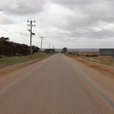
The road takes us to the Northam town turn off and we head east on Great Eastern Highway. This is the road east to Kalgoorlie and then south to Norseman and on to the Nullarbor and east to Adelaide and Melbourne.
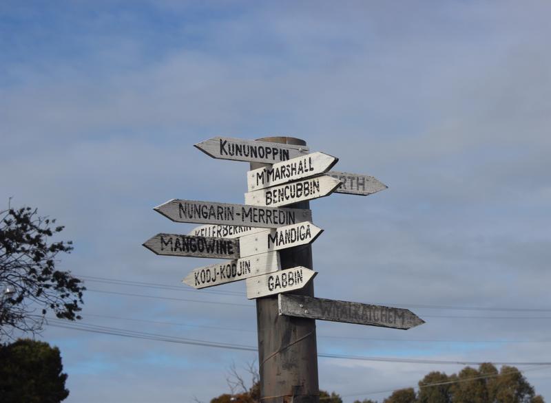
The road is quiet, and we decided to take the off shoot road and follow The Pioneer's Pathway drive route. This takes us right into the wheatbelt and wheatfields area. The area has large fields of over 1,000 acres and the odd house and then it’s through small towns. We pass through Dowerin & Goomalling when around 6.25pm whilst we were coming around a corner we see a large kangaroo in the middle of the road. We managed to swerve to avoid him, but it’s like hitting a cow at speed, not a good thing for the car or the kangaroo. So we decided to camp at the next town, which is Wyalkatchem.
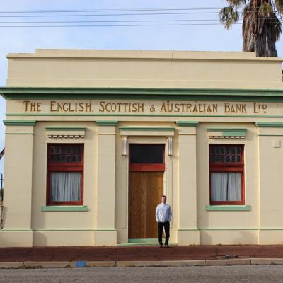
This is a typical small local town with a nice camp site and showers/toilet etc., and a short walk to the local hotel/pub. The town has one main street, a few shops and a few supporting things like garage, but everything else has closed. The butcher, the baker, the grocer, the book sellers etc. It’s down to a pub, small teashop and a IGA grocery store. The population of the small community has gone from 400 families to 40 so the high school has closed and only a small primary school remains. This will also not last long. The price of houses has fallen so much that people are coming from Perth to have them as holiday homes. However, this makes the town even less vibrant during term time.
We walked down the middle of the road to and from the hotel and there were no cars. The pub had most of the town out which was 8 people in total and there were the usual old blokes holding up the bar, the young guys who had not got out and a few crazy sorts that would not survive outside a small town. That along with the 'skimpy' barmaid made it an interesting evening. The big fire was nice and we had a game of pool, talked to the locals and were back to the campsite by 10.00. There was no one else camping and it was very nice as the stars were on full show as no light pollution. The camp site was clean and tidy and you paid using an honour system.
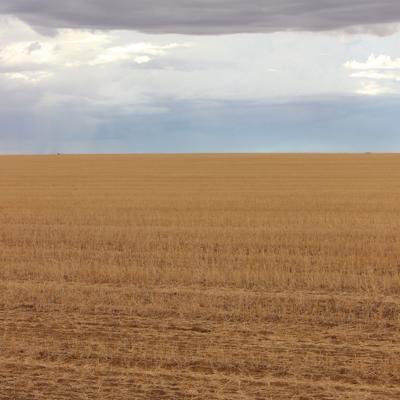
Friday morning started cold and dry and we headed off the road towards Kalgoorlie. We went via small towns like Nurgarin and Bullfinch getting smaller and wheat fields getting larger. This year’s rains have been good so there was good looking corn growing all around. In some years the crop can fail as the rains do not come. The field sizes got bigger as we went further east.
On the way we pass through a little town called Trayning. We found
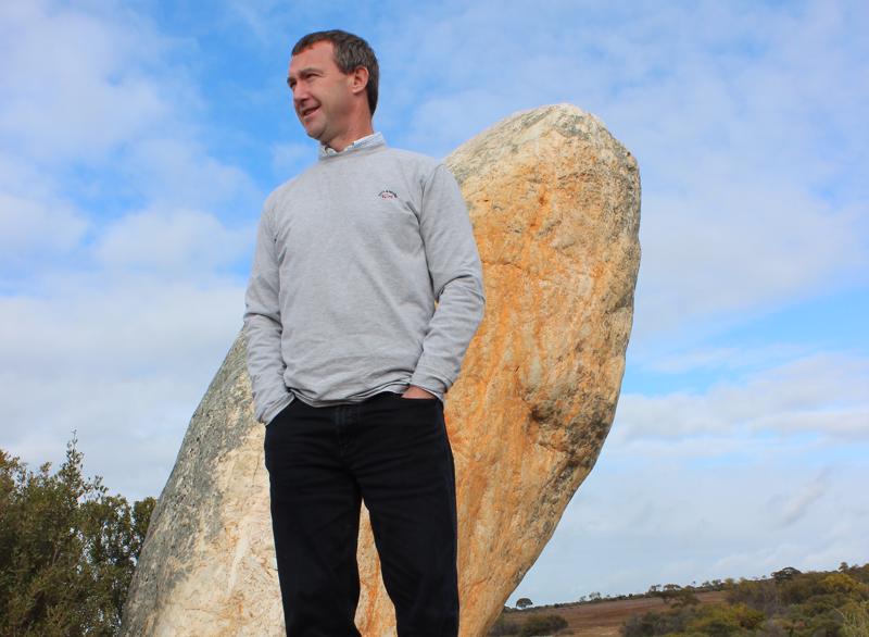
Whiteman's Rock which we were told was a large white quartz 'finger like' structure where gold was found in 1887 - so we thought we would take a look. Upon finding this structure, it appeared it was not 'finger like' but more 'phallic like'.
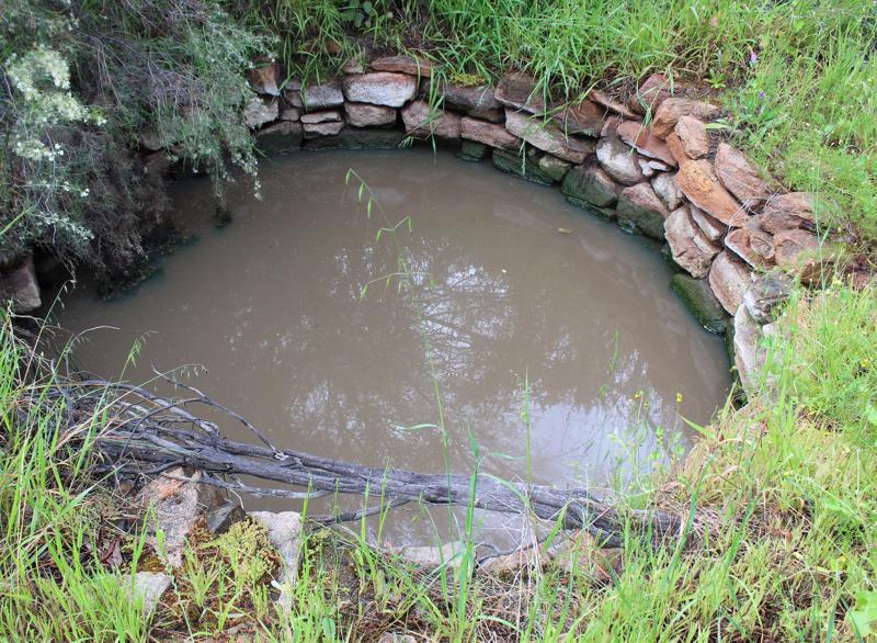
The added extra to our little detour was finding the old Trayning Well. This was first tendered in 1879 and is a small tank in the ground 10 feet wide by 14 foot deep set in stone and surrounded by saplings. The Well was an important source of water for early settlers.
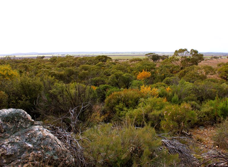
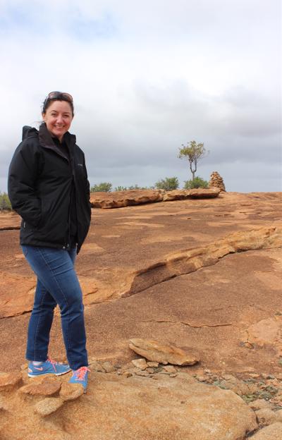
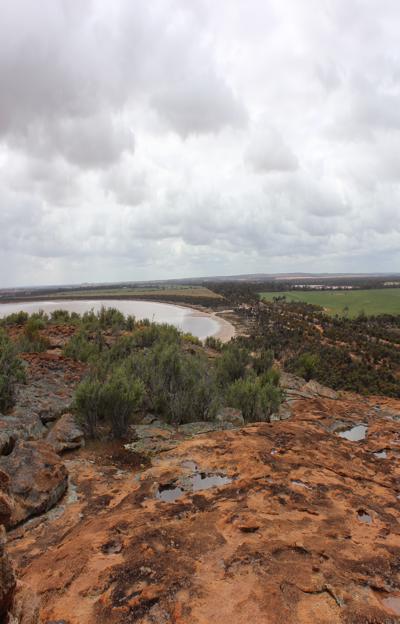
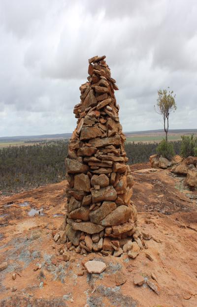
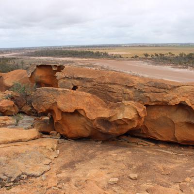
Upon our dirt track we discovered Billyacatting reserve which was first discovered in 1889. We undertook the 2.4km walk to the top where we found the trig beacon located 410m above sea level.
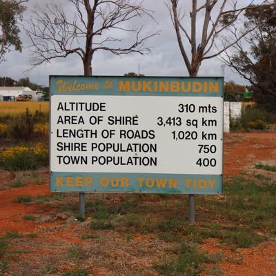
We continued on through Mukinbudin towards Westonia passing through a pretty much non existent town of Bullfinch which then led us to Southern Cross.
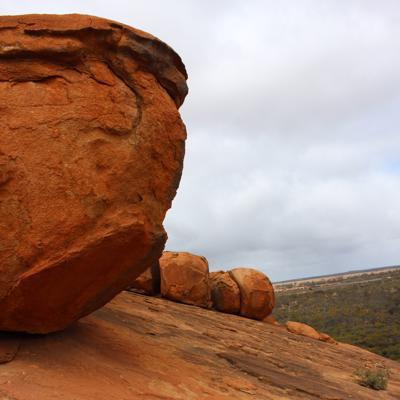
We stopped in for lunch at Karalee Rock and Dam and enjoyed lunch in the open air surrounded by flies and took in the sights at this old dam structure.
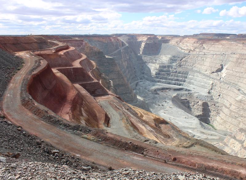
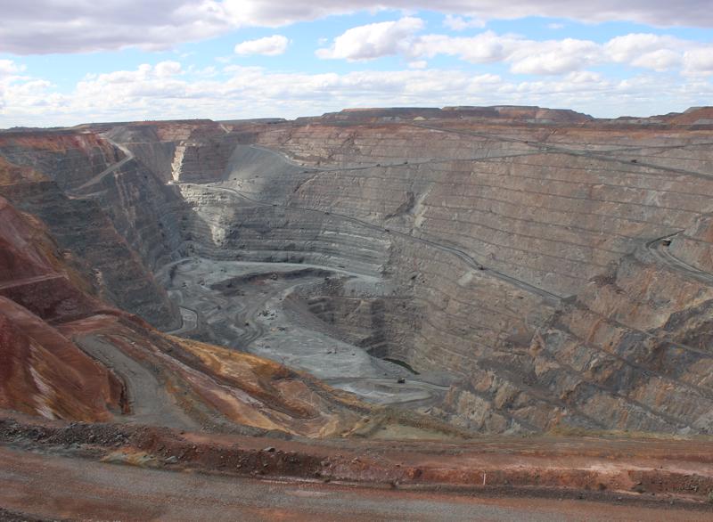
We got into Kalgoorlie early afternoon and went to look at the super pit. It’s massive and one of the deepest holes in the world. They are planning to keep digging downward till 2029 when the ore is expected to run out. However, there are places on the side where its estimated there may be more gold so the pit could be extended even further. Once we drove around the town it was time to head out to the real outback. The town is just pubs and support for the mining and not much else. It can be rough and the police do a reality show there and its domestic violence, drunks, bar brawls etc.
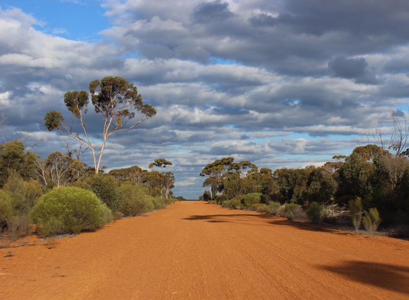
We headed south to Coolgardie and then off the Nepean-Burra road on a south west direction along an old trail into the Australian south west forest. It’s like a Mediterranean forest and is a large area of undisturbed land the size of the UK that is dry and forested. The roads are dirt tracks but passable and clear with some sections of heavy corrugations. We drove for over three hours towards Burra rocks. and arrived just before dusk.
1.
Introduction
2.
Perth to Burra Rocks via Wyalkatchem & Kalgoorlie
3.
Burra Rocks to Dumbleyoung
4.
Dumbleyung to Quairading
5.
Quairading to Home
6.
Perth to Dalwallinu
7.
Dalwallinu to Yalgoo
8.
Yalgoo to Morowa
9.
Morawa to Perth
10.
The Gold fields Perth to Mt Magnet
11.
Mt Magnet to Leonora
12.
Leonora to Westonia
13.
Westonia to Perth
Share your travel adventures like this!
Create your own travel blog in one step
Share with friends and family to follow your journey
Easy set up, no technical knowledge needed and unlimited storage!